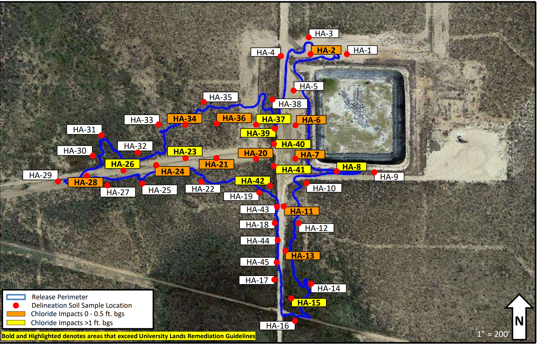
Would be amazing for GPS Walking Paths to be shown on a map view for environmental remediation sampling, large facility inspection walking paths, plus the documentation for OGI (Optical Gas Imaging) for LDAR inspections especially with the increased focus on SEC, EPA, and GHG/methane emissions.
See the sample below.