

Would be amazing for GPS Walking Paths to be shown on a map view for environmental remediation sampling, large facility inspection walking paths, plus the documentation for OGI (Optical Gas Imaging) for LDAR inspections especially with the increased focus on SEC, EPA, and GHG/methane emissions.
See the sample below.
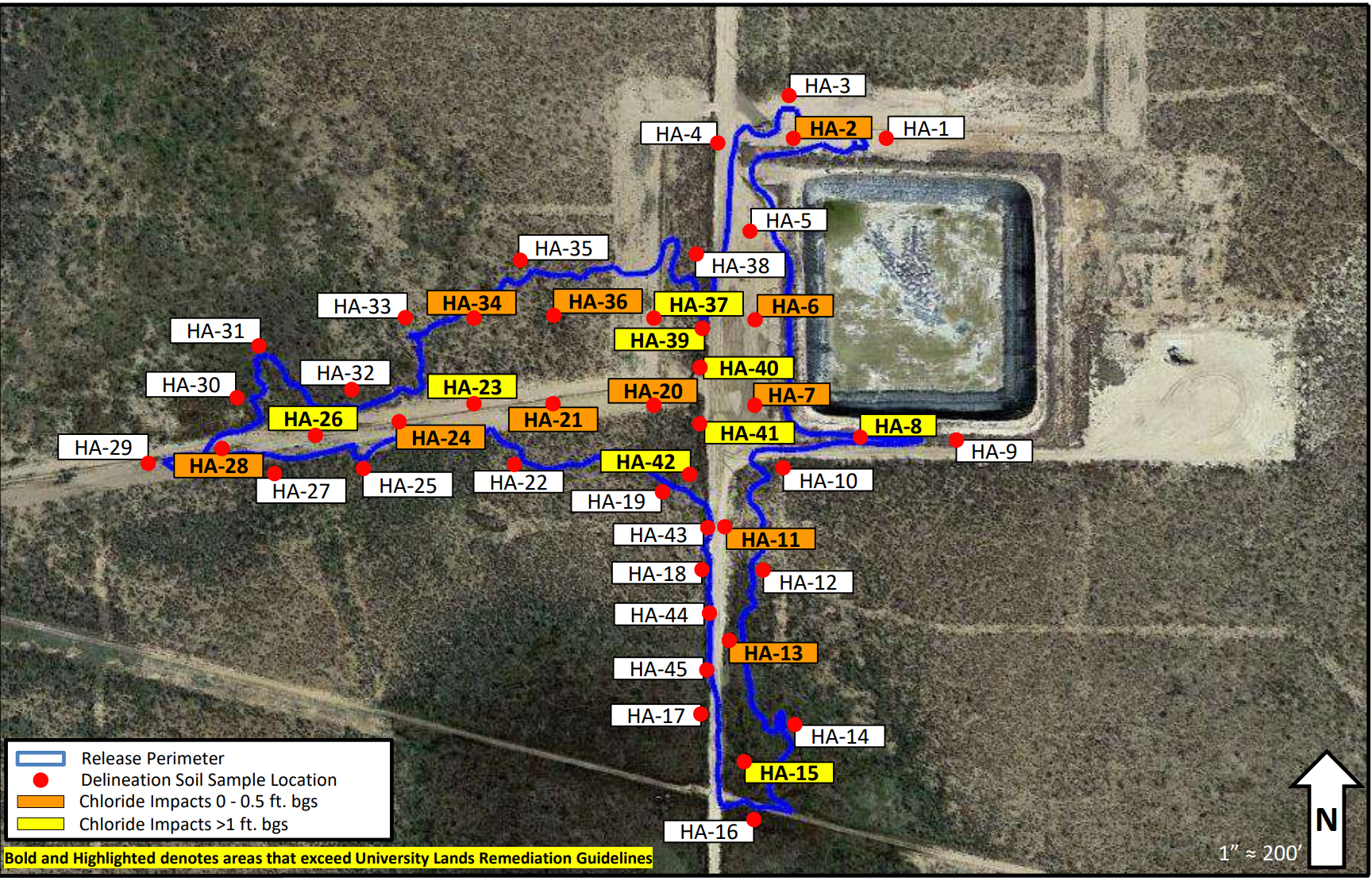
Hi@garybonnett thanks for sharing! We do have a feature that can be enabled upon request entitled “Map View” where we capture the location of where the responses were inputted but this feature doesn’t plot out the path, just a map view of where each answer was entered.
We’d love to know...Also was the photo shared on your above post created using a tool? And If so which tool?
Cheers!
Paddy.
Great thanks@garybonnett we will reach out for details separately to get that feature enabled for you and thank you for passing on those further details about the software.
Hi@Teralis Integration Partner - thanks for raising this! We can enable this feature however it is important that we preface it is still in BETA and does have the potential to be rolled back. If you’re happy communicate this with your customers and move ahead with it being granted, please let me know and I can reach out to you to get this enabled 
Thanks@Bianca.Taylor we're ok with Beta, perhaps we can just enable it in our partner account first to check it out.
Good idea! I will send you a private message to confirm the account and we can have that enabled for you